Water quality
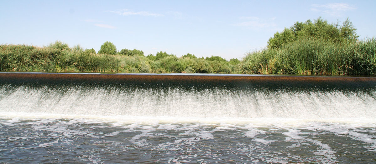
At the Las Vegas Wash, erosion and water quality are two major engineering and environmental concerns. The Wash is the only drainage channel for the Las Vegas Valley watershed and over the years, its flows have increased dramatically due to the rapid growth in the Las Vegas Valley. Prior to stabilization of the channel by the Las Vegas Coordination Committee (LVWCC), these increased flows led to a rise in erosion, sediments, total suspended solids (TSS) and other constituents, degrading water quality in the Wash and Lake Mead.
The increased TSS, largely derived from sediment from stream bed erosion, caused the Las Vegas Wash to be added to the 303(d) list of impaired waters by the Nevada Division of Environmental Protection. Thanks to the LVWCC's efforts, the channel has since been removed from the list.
The LVWCC has conducted regular water quality monitoring and sampling of the Wash for more than 20 years and coordinates its efforts with several partners that sample the Wash and Lake Mead: Bureau of Reclamation, U.S. Geological Survey, Clark County Regional Flood Control District, Nevada Division of Environmental Protection, City of Henderson, City of Las Vegas, Clark County Water Reclamation District and Southern Nevada Water Authority.
Water quality research
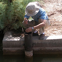
The real-time water quality monitoring program allows for collection of data at 20-minute intervals, 24 hours a day, 365 days a year. Sophisticated equipment logs pH, temperature, dissolved oxygen and electrical conductance. In addition, water quality samples are taken from the mainstream Wash, its tributaries and seeps.
We also conduct stream gauging to measure tributary flows and figure out how much volume ends up in the mainstream Wash. This information helps us determine the amount of contamination from urban runoff and the effects on water quality from specific land uses around the valley. Whether it's dumped on the ground out in the northwest section of the Las Vegas Valley or on the streets of Henderson, contamination knows no boundaries and will eventually make its way to the Wash through various tributaries and groundwater.
Mainstream water quality
The mainstream Wash water quality monitoring program was established in August 2000, to evaluate the baseline conditions of the Wash, to demonstrate water quality changes over time, to address the effects of increased wetlands systems on water quality, and to provide a long-term data history that can be used to make watershed-based decisions and evaluate the success of these management actions..
Currently, water samples are collected from ten strategic locations along the Wash on a quarterly basis. Besides field measurements (temperature, pH, electrical conductivity , and dissolved oxygen), samples are analyzed for major cations and anions, trace metals, nutrients (nitrogen and phosphorus), bacteria, and organic pollutants by internal and external EPA-certified labs.
Tributary water quality
The tributary water quality monitoring program, coupled with flow measurements, was established to characterize water quality in tributaries and to quantify the mass loading of pollutants from urban runoff to the Wash. Data from the program are essential for monitoring and tracking non-point sources of contamination from the surrounding community to the Wash. The project also is a cooperative program supported by both Southern Nevada Water Authority and Clark County Regional Flood Control District to meet requirements established in the Las Vegas Valley NDPES Municipal Stormwater Discharge Permit.
Six major tributaries to the Wash, including Duck Creek, Flamingo Wash, Las Vegas Creek, Monson Channel, Sloan Channel, and Burn Street Channel, monitored quarterly. The locations capture most major inputs of urban runoff from the Las Vegas Valley to the Wash. Besides field measurements (temperature, pH, electrical conductivity, and dissolved oxygen), samples are analyzed for major cations and anions, trace metals, selenium, nutrients (nitrogen and phosphorus), bacteria, and organic compounds.
Real-time water quality monitoring
Real-time water quality monitoring in the Wash and its tributaries provides valuable information on first-hand water quality in the areas monitored, including baseline data of water quality in the Wash and selected tributaries, real-time changes, and unusual water quality conditions.
Currently three stations are up-and-running in the Wash and its tributaries, including Duck Creek (DC_1) at Broadbent Blvd, downstream of Flamingo Wash and Las Vegas Creek (LW11.1), and below Lake Las Vegas (LW0.8). Duck Creek, Flamingo Wash and Las Vegas Creek are three major tributaries to the Wash. LW0.8 is located near the end of the Wash, representing the outlet of the Las Vegas Valley watershed. A device with multiple probes (such as a Hydrolab unit) and data loggers have been used to measure water temperature, pH, electrical conductivity, and dissolved oxygen. The multiprobe device remains in the water 24 hours a day throughout the year, recording and storing the collected data every 15 minutes.